With 1,200 hectares of reforested land managed worldwide, 600 species categorized and over 300GB of field images collected from a total of 20 projects, MORFO offers a large-scale solution for ecosystem restoration, mainly in tropical and subtropical regions. Our method is based on three main pillars:
- Selection of species for planting and seed encapsulation technology using forest engineering.
- Fast, precise planting using drones.
- Particular attention is paid to monitoring the evolution of plantations, based on biomass, biodiversity and carbon stocks. These analyses enable us to check that the forest is growing well, and to diagnose any problems or low success rates, in order to remedy them, for example through future plantations.
In this article, we explain the MORFO forest ecosystem restoration project monitoring method:
- How do we monitor?
- What do we analyze?
- When and for how long is our follow-up carried out?
- How do our customers access it?
MORFO forest monitoring is carried out using various tools
MORFO uses a number of tools to ensure accurate and regular monitoring.
Drone and satellite imagery
Diagnostic of the terrain to be reforested on the imagery side is almost entirely automated, with the exception of drone flight, for which we need a pilot (although flights are pre-programmed).
Our drones are capable of taking very high resolution images. They have access to remote and dangerous areas. They are a true scaling tool, ready to be deployed anywhere in the world.
Artificial intelligence
AI comes into play at various stages of our projects. In the context of monitoring and surveillance, we use AI to translate satellite images and data captured by drones into information that can be used to assess biomass growth: analysis of plant cover, counting of species that have germinated.
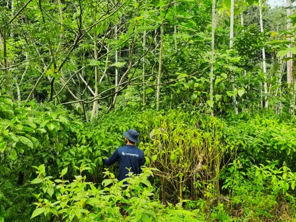
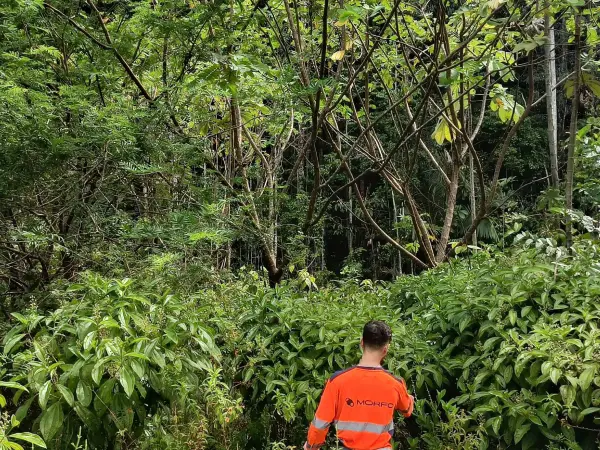
Field analysis
On-site analyses include the use of drones for imaging, soil testing and sampling, and vegetation cover studies.
More than 1,000 people work directly or indirectly with MORFO. Our close collaboration with local populations means that we benefit from their help in forest monitoring, taking photos and samples in the field, which are then sent to the laboratory for analysis.
During monitoring, a number of parameters are analyzed
Inicial diagnostic
Before any work is carried out, a complete diagnostic of the site is carried out. This includes :
- Soil analysis: physical characteristics (compaction, density, porosity, texture, traces of erosion, slope), chemical composition (pH, nutrient content, potential pollutant content) and biological data (number and diversity of bacteria and fungi).
- Climate analysis: average annual temperature, annual precipitation, aridity index, altitude.
- An inventory of species already present or not on the site to be reforested and in the surrounding forests, on the different plant strata: analysis of tree density, distribution, height and diameter.
Forest Restoration Monitoring
Forest cover is monitored by :
- Biomass growth in percent since the start of the reforestation project.
- The biodiversity index (known as the Shannon Index), which is the ratio between the number of species present and the number of individuals. It expresses the specific diversity of a studied stand.
We create maps of the terrain that evolve over time. These maps are 2-dimensional and 3-dimensional views (with satellite and drone images respectively) of parameters such as :
- The overall vegetation situation
- Green Leaf Index
- Humidity monitoring
- Infrared vegetation monitoring
Carbon tracking
Initial, potential and current carbon stocks (measured in tonnes of CO2e / hectare) are currently determined using above-ground biomass estimates obtained from UAV imagery. To estimate root biomass from above-ground biomass, we use allometric equations. Once we have obtained the total biomass (i.e. above-ground plus root biomass), we can calculate the amount of carbon, assuming that a tree contains around 47.5% carbon.
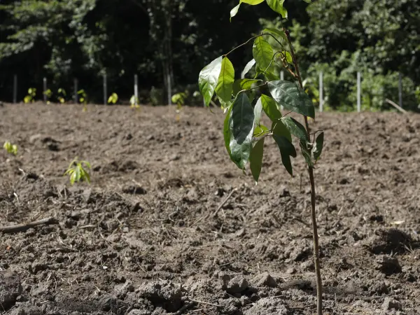
Photos of the site
On-site photos of the land are also taken to see plant growth in detail. These include tree type and size, canopy density, insect and animal presence, etc.
MORFO forest monitoring is regular and long-term
Restoration monitoring extends over a period of 5 to 30 years, depending on the project, to ensure rigorous monitoring of the evolution of the restored area and guarantee its sustainable recovery. This period varies according to the complexity and scale of the restoration project, as well as the objectives of conservation and ecosystem preservation.
To ensure complete and accurate monitoring of the restored area, an observation system has been set up. High-resolution satellite images are captured regularly, approximately every 3 months, enabling changes to be monitored at different temporal scales. These images provide a global view of the evolution of vegetation, hydrology and land use in the area concerned.
During the first three years after restoration, particular attention is paid to the initial recovery phase. On-site surveys, using drones and qualified field crews, are carried out every 6 months. These surveys provide more detailed data and enable us to closely monitor plant growth, the reappearance of wildlife and any transformations in the natural environment.
After this critical period, when the restored area has reached satisfactory stability, on-site surveys are spaced out and carried out every year. We maintain regular monitoring, while taking into account the capacity of the restored ecosystem to self-regulate. These annual surveys provide essential information on the long-term evolution of the area, its ecological recovery and its resilience in the face of environmental change.
This extensive and meticulous monitoring process ensures that environmental restoration efforts in the area produce tangible and lasting results. The data collected throughout this process also helps to improve future ecological restoration initiatives and to better understand the underlying mechanisms involved in ecosystem regeneration.
A comprehensive dashboard allows you to monitor the progress of the reforestation project in real time.
We accompany our forest restoration projects hand-in-hand with our customers, offering them a central role in their follow-up.
Thanks to our comprehensive dashboard, it is possible to access the diagnoses carried out by our teams in the field before, during and after our operations on a single platform. Images, maps and key figures make it easy to see how projects are progressing. Project progress and data are visible and directly downloadable via the dashboard.
.webp)
Collaborate with MORFO and restore your operations: test our dashboard by clicking here.