Restoration projects generate data everywhere. Decisions get made nowhere.
A satellite image says the land is degraded pasture. A drone orthophoto reveals a gully that the satellite missed. A soil sample shows pH 4.3 and severe compaction at 30 centimeters. A climate model projects declining suitability for half the planned species by 2070. Each source tells part of the story. None tells enough to act on alone.
The problem is not a lack of data. It is the gap between having data and having a basis for decision.
What each source sees - and what it misses
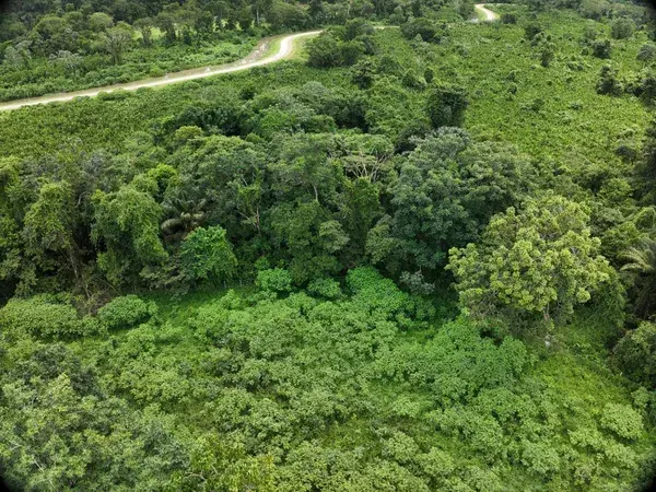
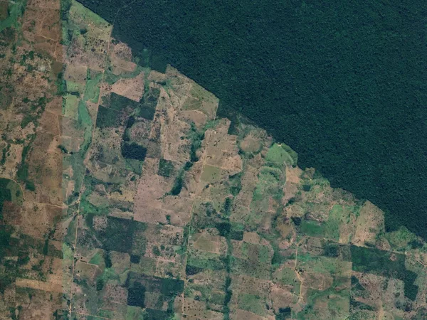
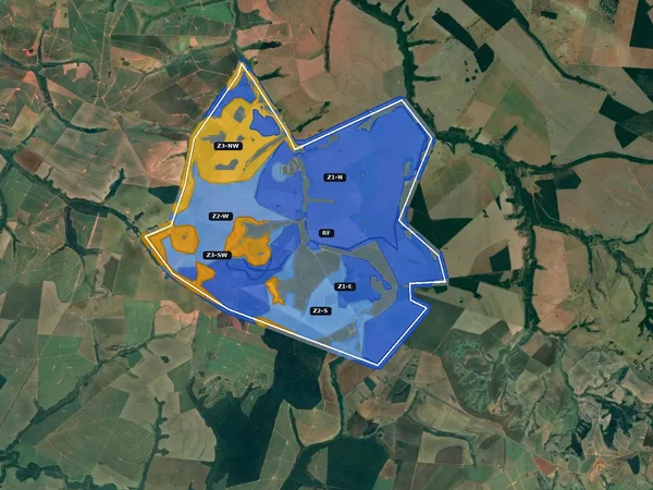
Satellite imagery provides the macro view. Slope gradients across the entire property. Vegetation cover classified by type - pasture, degraded, secondary growth, native forest fragments. Fire history over the past decade. All of this at 10-meter resolution, updated every few days, covering any site on Earth.
What satellite cannot see: the pH of the soil. Whether the ground is compacted at 30 centimeters. Which invasive species are present and how deep their roots go. The satellite sees the surface. The decisions that determine success or failure happen below it.
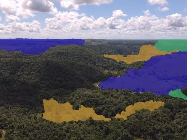
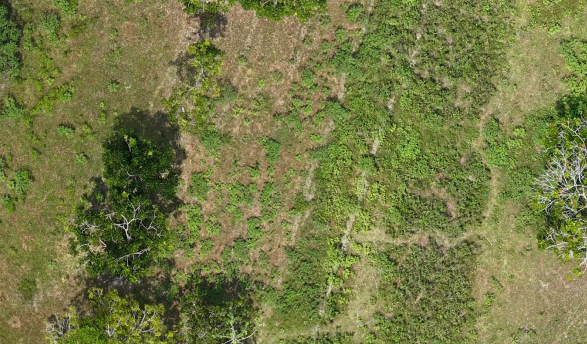
Drone orthophotos close the resolution gap. At 1-3 centimeter resolution, a drone survey captures erosion channels, individual tree crowns, standing water, access paths, and micro-terrain features that satellites cannot resolve. Multispectral sensors add NDVI and NDRE indices at plant-level precision.
What drones miss: they capture a single moment. A drone flight in the dry season shows one reality; the same area in the wet season may be impassable. And drone surveys are expensive enough that you cannot fly every site every month.
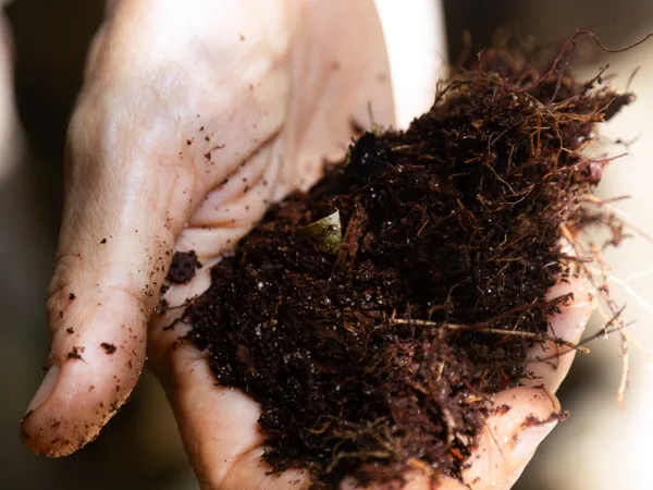
Field surveys deliver the ground truth that no remote sensor can provide. Soil chemistry from laboratory analysis: pH, nitrogen, phosphorus, potassium, cation exchange capacity, organic matter content. Penetrometer readings that reveal compaction layers invisible from above. Floristic inventories that identify every species present.
What field data misses: coverage. A field team can visit 12-15 measurement plots across an 8,000-hectare site in a two-week campaign. Precise data at each plot, but the space between plots is interpolated, not measured.
Models project what has not yet happened. Climate trajectories under different emission scenarios. Carbon sequestration curves based on allometric equations. Species suitability ranges for 2040, 2070, 2100.
What models miss: they are hypotheses, not measurements. A carbon projection is only as good as the baseline it starts from and the field data that validates its assumptions. Models without ground truth are speculation.
When sources contradict each other
The most valuable moment in a diagnostic is when two sources disagree.
Satellite analysis classifies a zone as operable - moderate slope, adequate rainfall, no legal constraints. Then the field team arrives and finds laterite compaction at 25 centimeters that makes conventional soil preparation impossible without deep ripping. The satellite was right about the surface. The field data reveals a subsurface reality that changes the entire treatment prescription.
Or: a drone orthophoto shows what appears to be healthy vegetation cover across a riparian buffer. But the floristic inventory identifies that 80% of the cover is Leucaena leucocephala - an aggressive exotic species. The drone saw green. The botanist saw a problem.
"Each data source has a confidence interval. Satellite gives you the big picture with known blind spots. Drone gives you precision at a single point in time. Field gives you depth at sample points. Models give you the future with stated assumptions. The value is not in any single source - it is in knowing exactly what each one can and cannot tell you." - Jeremy Giral, Platform and Data Engineer, MORFO
These contradictions are not failures. They are the diagnostic working as intended. The entire point of layering four sources is to catch what any single source would miss.
The carbon market is learning this the hard way. Canopy maps built on unprocessed satellite data. Height models riddled with cloud artifacts. Biomass layers that have nothing to do with what is actually growing on the ground. Beautiful maps are not the same as good science.
Confidence, not certainty
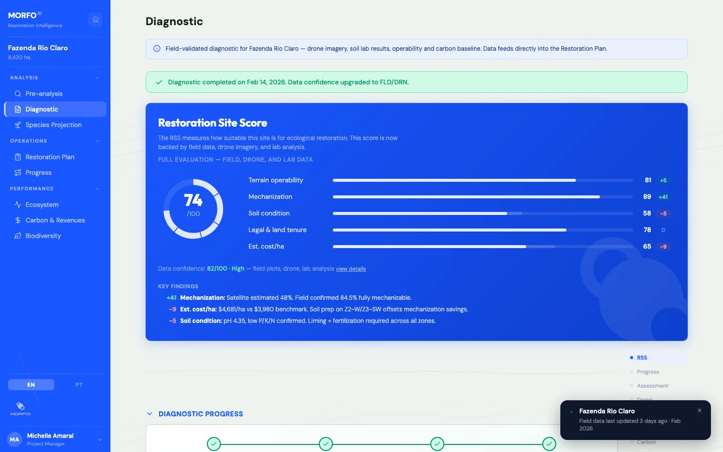
Every data point in a restoration plan carries a source. Satellite-derived estimates are tagged as such. Field-validated measurements carry a different confidence level. Modeled projections are explicit about which assumptions they rest on.
"The terrain always has the last word. We can model, we can fly drones, we can analyze satellite time series. But the soil sample, the penetrometer reading, the species count in the field plot - that is what converts a hypothesis into a prescription." - Rebecca Montemagni Almeida, Senior Forest Ecosystem Engineer, MORFO
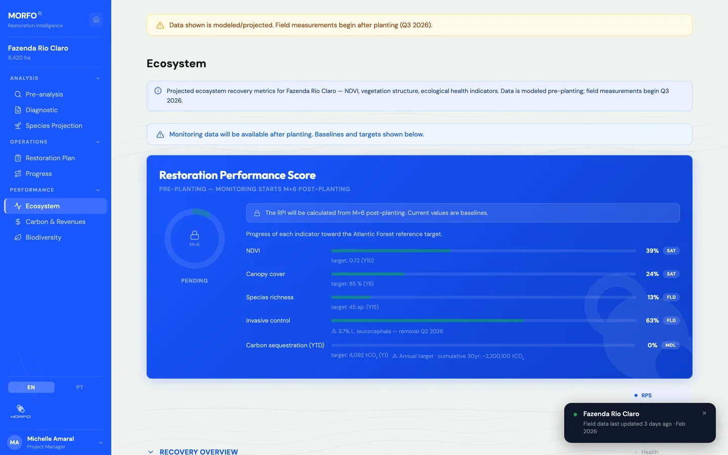
The goal is not to eliminate uncertainty. It is to make uncertainty visible, traceable, and bounded. When someone asks "how do you know this zone is operable?" the answer should be: "satellite slope analysis (SAT, 10m resolution, March 2026) shows 78% below 15 degrees. Field penetrometer readings (FLD, 14 plots, December 2025) confirm workable compaction above 30cm. Drone orthophoto (DRN, 2cm resolution, November 2025) shows no erosion channels in the mechanization corridors."
Four sources. One decision. Every link in the chain visible.
MORFO builds restoration intelligence for large-scale forest projects across three biomes in Brazil. 27,000+ hectares analyzed, 24 active projects, 1,900 hectares under management, 30 forest engineers and ecologists.
Request a site analysis or explore the platform at morfo.rest/restoration-intelligence