Where Legal Amazon deforestation fell or rose in 2026, by municipality
Area cleared in 2026, by municipality
- 5 km²
- 25 km²
- 100 km²
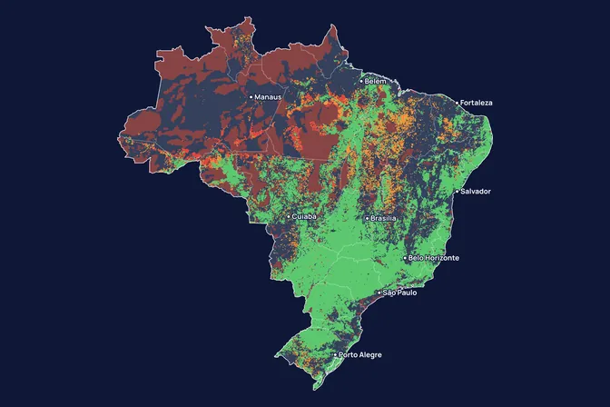
- Standing forest
- Already deforested by 2025
- No forest (savanna, grassland, water)
What the map shows
According to INPE's estimate, the Legal Amazon lost 3,335 km² of forest between August 2025 and July 2026, 42% less than the year before and the lowest rate since 1988. The fall was not even: among the 169 municipalities with 5 km² or more of clearing, 122 went down and 47 went up. Altamira, in Pará, came first with 156 km², 26 km² more than in 2025. We made this map to show where pressure on the forest is easing and where it continues.
How we built it
We used PRODES, INPE's system that maps clear-cutting of primary forest in the Legal Amazon by satellite, year by year, from August to July. For the municipality maps, we added up the increments mapped in 2026 in each municipality, 3,460 km² in total, and compared them with 2025. The state charts use the official rates from 2019 to 2026. The map can be refreshed at each new INPE release.
What the map does not say
- The 2026 figure is INPE's provisional estimate. The consolidated rate comes out next year.
- The municipality maps use the mapped increments (3,460 km², 34% less than in 2025), not the official estimated rate (3,335 km², 42% less). That is why the totals differ.
- Each circle sits at the municipality's centre, not where the clearing happened. This matters in huge municipalities such as Altamira.
- PRODES measures clear-cutting of primary forest. Degradation, fire and secondary vegetation are left out.
- Change is measured in km², not %. Municipalities with under 5 km² cleared in both years have no circle.
How we use this data to analyse an area
On an area
Deforestation pressure is one of the 21 criteria MORFO combines to assess an area. In our reading, active clearing around an area is a risk to the permanence of what is restored, especially in a carbon project. In the MORFO Ri pre-analysis, we cross PRODES and DETER alerts around each area.
What MORFO does next
- Prescribes what to plant, at what density and with what soil preparation.
- Organises the seeds.
- Plants with our field partners.
- Measures the results over the years in MORFO Ri.
The data
INPE, PRODES Legal Amazon: official rates by state (file of 16 October 2026, with the 2026 estimate) and mapped increments by municipality, August to July years, open data (TerraBrasilis). MORFO analysis. See the sources
MORFO scientific team · Version 1, updated November 2026
Related maps
How to cite
MORFO Data. Where Legal Amazon deforestation fell or rose in 2026, by municipality. MORFO scientific team, version 1, November 14, 2026. Available at: https://www.morfo.rest/resources/data/deforestation-2026
CC BY 4.0 licence: reproduce with this citation and a link to the page. Source data keep the licence of each source.
Want this analysis for your area?
- Send your areaLocation, polygon or CAR number.
- Talk with the teamTo understand the project.
- Pre-analysis of the areaBlockers, operable area, site score and first methods.
MORFO Restoration Intelligence is the platform where each area's pre-analysis, plan and follow-up come together. See MORFO Ri
Your area
LET'S GROW with MORFO